Bali Pass sits high between the Har Ki Dun – Ruinsara side and the Yamunotri side, so it naturally connects two very sacred valleys. On one side you have Har Ki Dun, often called the Valley of Gods with strong links to the epic Mahabharata. On the other side you drop towards Yamunotri, one of the four Char Dham shrines dedicated to Goddess Yamuna. Because of this position, Bali Pass is not only a mountain crossing, it is a cultural bridge between two important holy regions in Uttarakhand.
For many years before modern trekking, high passes like Bali Pass were used by shepherds, traders and local villagers to move between the Tons valley and the Yamuna valley. They crossed with flocks, wool, grains and daily goods during the snow free months and returned before winter. When you walk over Bali Pass today, you are following the same old seasonal route that helped people, animals and trade flow between these river systems.
From around Bali Pass you see big peaks like Swargarohini, Bandarpoonch and Black Peak Kalanag. In local stories these mountains are linked with the final journey of the Pandavas and with gates to heaven. For people living in these valleys, these are not just rock and ice, they are connected with old stories, local gods and respect for the high mountains. Standing on Bali Pass and looking at these peaks, you are in the middle of this mythic landscape that villagers grow up hearing about.
The two sides of Bali Pass also show two different ways people use the mountains. The Ruinsara side feels quieter, with grazing grounds and small village temples for local deities. The Yamunotri side has a strong pilgrimage flow, with many visitors, priests, lodges and ritual bathing at the hot springs and in the river. When you cross Bali Pass you feel this shift very clearly, from remote pasture culture to an active holy route.
Today Bali Pass Trek has also become a kind of badge trek for serious trekkers in India, a difficult pass that many want to complete after easier routes. Even with this modern adventure image, the pass still lies inside an old spiritual and cultural zone shaped by Har Ki Dun, Swargarohini and Yamunotri. So every person who crosses Bali Pass is walking on a line where tough mountain sport and deep local faith quietly meet.
Bali Pass lies between the Har Ki Dun–Ruinsara side and the Yamunotri side, so it naturally sits between two holy valleys. One side is linked with old stories from the Mahabharata, the other with an active Char Dham pilgrimage route.
Har Ki Dun and Swargarohini are closely tied with the Pandavas. Local belief says the Pandavas walked through this valley on their last journey and that Swargarohini is a path to heaven. Because Bali Pass is on the same high ridge system, many people see it as part of this larger sacred landscape.
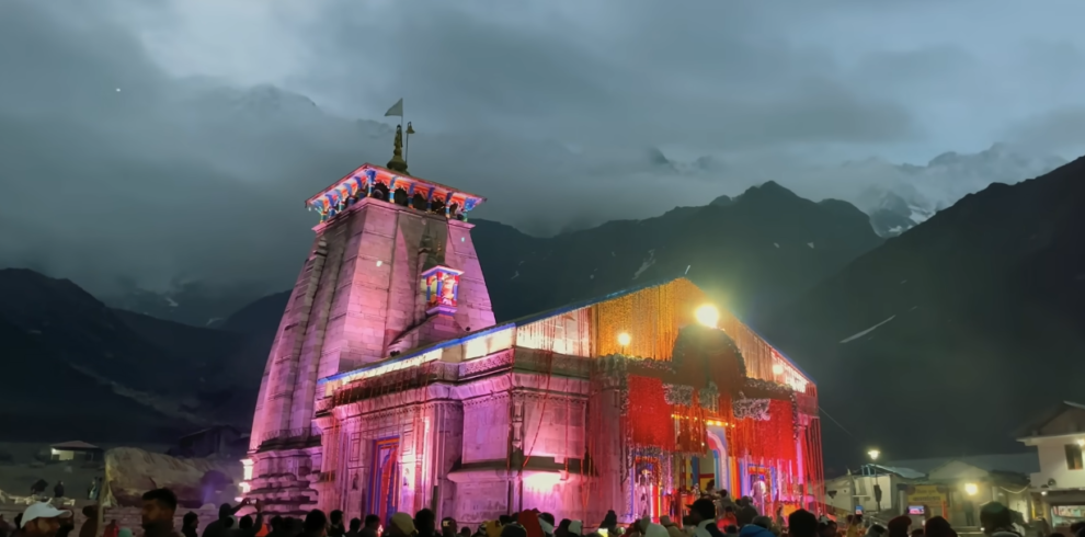
Yamunotri on the exit side is one of the four Char Dham temples. It is dedicated to Goddess Yamuna, and the springs and river here are treated as holy. Pilgrims come to pray, bathe in the hot water, and ask for protection and blessings for their families.
Bali Pass therefore connects a myth-filled valley of the Pandavas with a living temple of Goddess Yamuna. Many local people treat this high area with extra respect, avoid loud behavior near shrines and cairns, and offer small prayers before crossing, seeing the pass as a serious, blessed gateway rather than just a trekking spot.
On the Bali Pass Trek, the lower part of the route passes through rich Himalayan forest. You walk under pine, deodar, oak and walnut trees, with rhododendron blooming in red and pink in late spring and early summer. This mix of tall trees, shade and streams gives the first days of the trek a green, cool feel and is a key part of the flora of Bali Pass region.
As you gain height and move towards Devsu Thach and the approach to Ruinsara Tal, the forest opens into wide meadows (bugyals) and high grasslands. In season these meadows are filled with wildflowers like small primulas, anemones and other low alpine plants that can survive strong sun and cold nights. This is where the landscape starts to feel more open, with long grass slopes, scattered bushes and big views of the Garhwal Himalayas.
Much of the Bali Pass Trek lies inside or close to Govind Pashu Vihar National Park, which protects a range of Himalayan wildlife. The area is home to animals such as musk deer, Himalayan tahr, bharal (blue sheep) and Himalayan black bear. These animals are shy and stay away from busy trails, so trekkers usually see only hoof marks or droppings rather than the animals themselves. More common sights are Himalayan langur, small rodents and, near villages, herds of sheep, goats and mules sharing the path.
Bird life is very active on this route. The forests and meadows can host Himalayan monal, koklass pheasant, eagles, vultures and many small songbirds. Early morning and late evening are the best times to hear and spot them around camps. In warmer months there are also butterflies and bees around the flowers, while at higher camps near Bali Pass itself, life becomes more limited to hardy grasses, dwarf shrubs like juniper and a few tough alpine plants that can grow between rocks.
Because the flora and fauna of Bali Pass region are fragile, trekkers are expected to follow basic leave no trace rules. That means staying on the marked trail, not plucking flowers, not feeding any wild animals, keeping noise low near wildlife and carrying back all plastic and waste. This helps keep the Bali Pass Trek clean and protects the natural life of Govind Pashu Vihar National Park for future trekkers and for the local communities who live here.
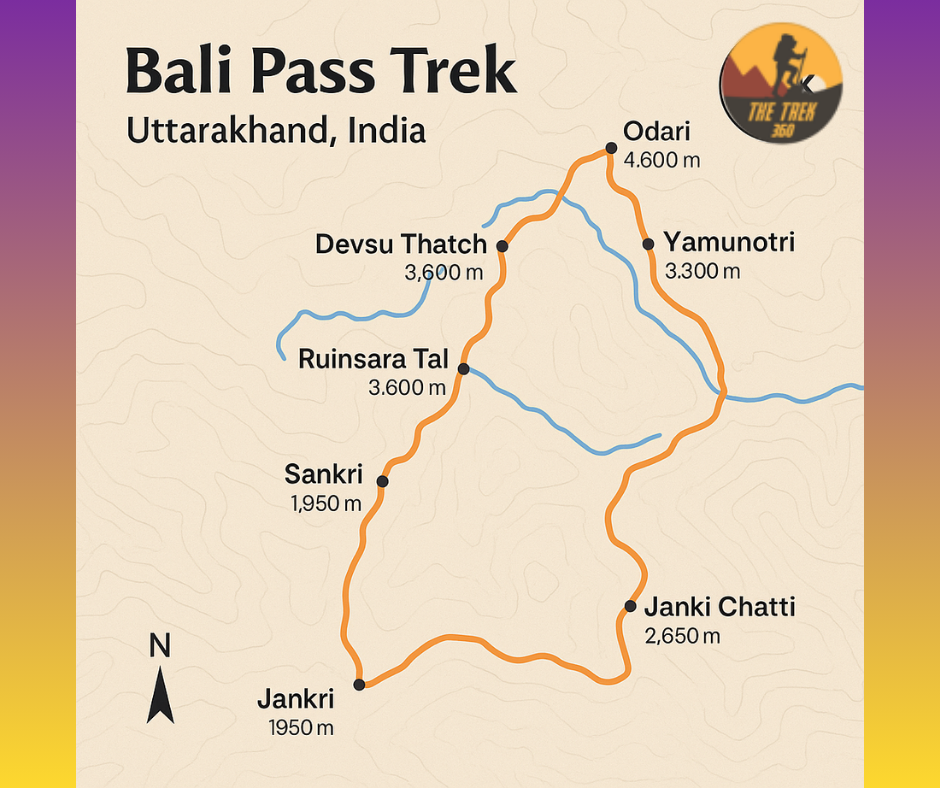
Bali Pass Trek lies in the Garhwal Himalayas of Uttarakhand, between the Tons river valley on the Har Ki Dun–Ruinsara side and the Yamuna valley on the Yamunotri side. The pass itself is around 4,950 metres high and sits on a long ridge that divides the Tons basin from the Yamuna basin.
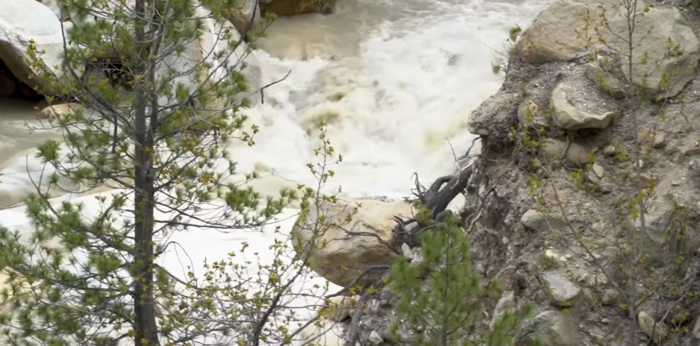
The lower part of the trail follows rivers and side streams that feed the Tons River. This section is steep but green, with terraced fields, traditional wooden villages and thick forest on both sides. The path often runs close to the water, crosses simple wooden bridges and passes through narrow valleys where the mountains rise sharply above you.
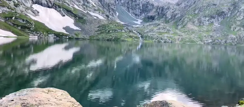
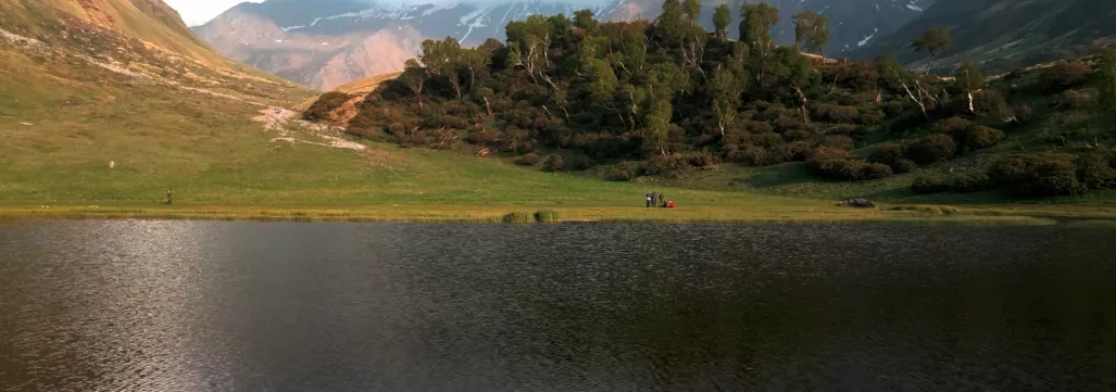
As you climb higher, the landscape opens into wide alpine meadows like Devsu Thach and then into the natural bowl around Ruinsara Tal. This area has grass slopes, rocky walls and snow peaks forming a clear high Himalayan amphitheatre. Ruinsara Tal itself sits quietly in this bowl like a small clear lake reflecting the surrounding ridges.
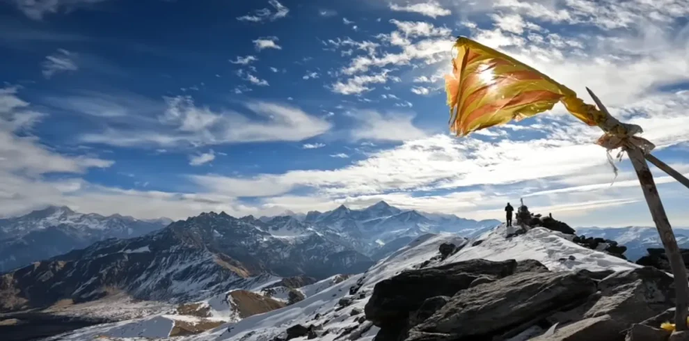
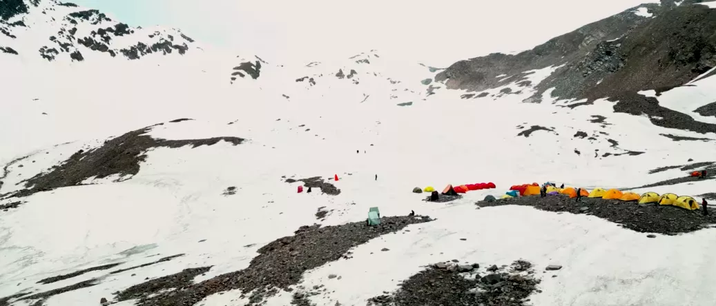
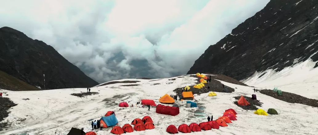
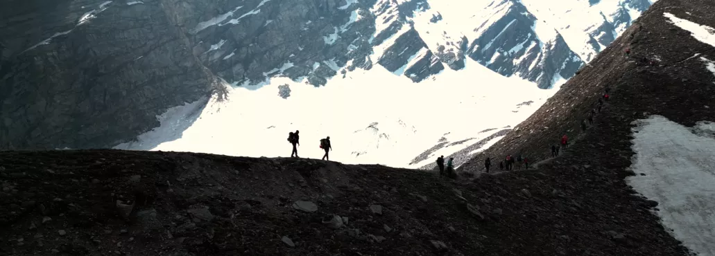
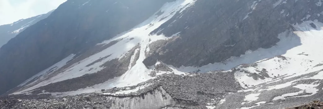
Near and above base camp, the ground becomes harsher and more rocky. Trees fade out, the soil gets thin, and the trail moves over loose moraine, boulders and, in season, long snow slopes. The final climb to Bali Pass is a steep slope leading to a narrow saddle on the ridge, with big views of Swargarohini, Bandarpoonch and Black Peak on clear days.
On the Yamunotri side, the descent drops quickly into a new valley. The upper section is made of scree and rocky gullies, then the path enters mixed forest again and follows streams that join the Yamuna. Here the landscape feels more settled, with small settlements, pilgrim paths and the road that goes up to Yamunotri, completing the crossover of the Bali Pass Trek.
The best time for Bali Pass Trek is in two main seasons: summer (May–June) and autumn (September–mid October). In these months, the trail is open, weather is more stable, and most trek operators run regular batches for this high altitude trek in Uttarakhand.
In May and June, you get a proper mix of greenery and snow. Forests are fresh, rivers are full, and there is still good snow near base camp and Bali Pass, so many people prefer this time for a classic Bali Pass trek with a snow experience.
From September to mid October, the sky is usually clearer after the monsoon. Views of Swargarohini, Bandarpoonch and Black Peak are very sharp, meadows turn golden, and the air is crisp. This is the ideal window if your focus is big mountain views and a calm Bali Pass trek.
July and August are not advised because of heavy rain, landslides, and swollen streams on the route. Late October to April also stays risky for normal groups due to very low temperatures, deep snow, and possible avalanche zones, so these months are generally avoided for Bali Pass Trek.
In the summer season (May–June), days on the Bali Pass Trek are cool and nights are cold. At the lower camps near villages, daytime temperature usually stays around 10°C to 18°C, with nights around 5°C to 10°C. As you go higher towards Devsu Thach and Ruinsara Tal, days feel cooler (around 8°C to 15°C) and nights can drop close to 0°C. Near base camp and Bali Pass, you can still find snow, and night temperature can go down to 0°C or even a bit below.
In autumn (September–mid October), the air is clearer and drier, which gives great views but also sharper cold. Lower camps are still comfortable in the day, around 8°C to 15°C, but nights get colder than summer. Around Ruinsara Tal and base camp, daytime can be 5°C to 10°C, while night temperature often slips to 0°C or below. Close to the pass, early morning wind can make it feel well below freezing, even if the thermometer shows only a few degrees under 0°C.
The weather pattern on Bali Pass Trek is typical high Himalayan weather. Mornings are often clear, clouds can build by afternoon, and evenings turn cold quickly once the sun goes down. Wind is a big factor at higher camps and on the pass itself. A light breeze in the valley can feel like a strong, icy wind on the ridge, so windproof layers are just as important as warm layers.
Outside the main trekking windows, the monsoon months (July–August) bring heavy rain, mist and slippery trails on the lower sections, along with the risk of landslides and swollen streams. From late October into winter and early spring, deep snow, strong winds and very low temperatures make the route unsafe for regular groups. Because of this, most people plan their Bali Pass Trek in the summer or autumn windows when both Bali Pass weather and Bali Pass temperature are challenging but manageable with proper gear.
🔹 Clear, Honest Difficulty Rating
We don’t sell Bali Pass as an “easy” or “beginner-friendly” trek. We call it what it is – a difficult high-altitude trek – so you know exactly what you’re signing up for.
🔹 Safety Before Summit
Bali Pass at 4,950 m is serious terrain. Our focus is safe pacing, proper acclimatisation, weather-based decisions and a clear evacuation plan, not just “reach the top at any cost”.
🔹 Small Group Approach
Smaller groups mean better control on steep sections, faster response in emergencies and more attention to each trekker, instead of getting lost in a big crowd.
🔹 Experienced Local Guides
We work with local mountain staff who know the Bali Pass region, water points, alternate routes and weather signs, not just the GPS line.
🔹 Real Itinerary, No Shortcut Itinerary
Our Bali Pass plan keeps a sensible number of days, proper acclimatisation and realistic walking hours; we don’t squeeze the route just to make it look cheaper on paper.
🔹 Transparent Gear and Support List
We clearly tell you what we provide (tents, sleeping bags, safety gear) and what you must bring yourself, so there is no surprise at the base camp.
🔹 Practical Fitness Guidance
Instead of vague “be fit” lines, we give clear targets like 5 km timing and stair practice, so you can check if you are actually ready for Bali Pass.
🔹 Clean Mountain, Clean Camps
We follow simple but strict rules on waste: carry back trash, keep campsites clean and respect local villages and trails.
🔹 Support Before and After Trek
We help you plan travel to and from Dehradun, choose the right gear and understand the route so you don’t walk into a difficult trek blind.
🔹 Focus on Real Experience, Not Just Photos
The aim is a complete Bali Pass experience – landscape, culture, effort and learning – not just a few summit selfies and a rushed exit.
- No drugs, illegal items, or banned substances are allowed during the tour.
- Weapons, fireworks, and harmful items are strictly not allowed.
- If anyone breaks the rules or the law, they will be asked to leave the trip with no refund.
- Trek360 is not responsible for your safety if you go outside the campsite on your own.
- If you damage tents, pillows, mattresses, or any campsite items, you must pay the full cost.
- Trek360 is not responsible for any loss or theft of your personal things.
- Every guest must carry a valid government ID card.
- Only registered travelers are allowed inside the campsite. If you want to bring someone else, you must inform us earlier.
- Your booking is confirmed only after full payment is received.
- Trek360 is not responsible for any injury or loss during the trip. Please travel safely.
- Please help us keep the environment clean and safe.
- If the vehicle breaks down, you will have to wait until it is repaired. No extra vehicle will be provided.
- Delays may happen due to traffic or road conditions.
- Tickets or bookings cannot be exchanged, cancelled, or refunded.
- The AC of the vehicle will be turned off when the hill area starts.
- Misbehaviour of any kind will not be accepted.
Overview
This is a difficult Himalayan trek, planned for trekkers who already have experience of high altitude trekking in Uttarakhand. The usual Bali Pass trek itinerary takes 7–9 days, starting from Sankri / Taluka and ending near Yamunotri – Janki Chatti, covering roughly 55–60 km on foot.
On the route you walk through forests, riverside trails, villages like Osla and Seema, meadows such as Devsu Thach, the alpine lake Ruinsara Tal, and finally climb to the snow-covered Bali Pass with big views of Swargarohini, Bandarpoonch and Black Peak (Kalanag).
For The Trek 360, Bali Pass Trek is positioned as an offbeat, high altitude adventure trek in Uttarakhand for fit and prepared trekkers who want a raw trail, strong mountain views, and the classic Har Ki Dun – Ruinsara Tal to Yamunotri crossover experience.
Highlights
- High mountain pass (around 4,950 m / 16,200 ft) You cross a real high altitude Himalayan pass called Bali Pass, not just a small hill. This is a serious trek, not a picnic walk.
- Connects two famous valleys in one trek The route goes from Har Ki Dun – Ruinsara valley (Tons river side) to the Yamunotri valley (Yamuna river side). One trek, two different landscapes.
- Big views of major Himalayan peaks From many points, and especially near the pass, you see Swargarohini, Bandarpoonch, and Black Peak (Kalanag). These are some of the most famous peaks in Garhwal Himalayas.
- Beautiful alpine lake – Ruinsara Tal You camp close to Ruinsara Tal, a clear high altitude lake surrounded by mountains and meadows. Many trekkers call it the hidden gem of the Bali Pass Trek.
- Forest, riverside, meadows and snow – all in one trek The trail has thick pine and oak forests, long riverside walks, wide green meadows like Devsu Thach, rocky sections and finally snow near the pass. It gives a full trekking in Uttarakhand experience.
- Traditional villages and local culture On the lower part of the trek you pass old villages like Osla and Seema. You see wooden houses, temples and the slow village life of this part of Garhwal.
- Offbeat and less crowded trail Compared to popular routes like Kedarkantha, Bali Pass Trek is still offbeat, more silent, and less commercial. You get more raw nature and fewer trekking crowds.
- Challenging, rewarding trek for experienced trekkers With steep climbs, long walking days and high altitude, Bali Pass trek is a perfect challenge for fit trekkers who want to push themselves and enjoy a real adventure in the Indian Himalayas.